
Ball's Ferry Historical Marker
Ball’s Ferry
Marker Text
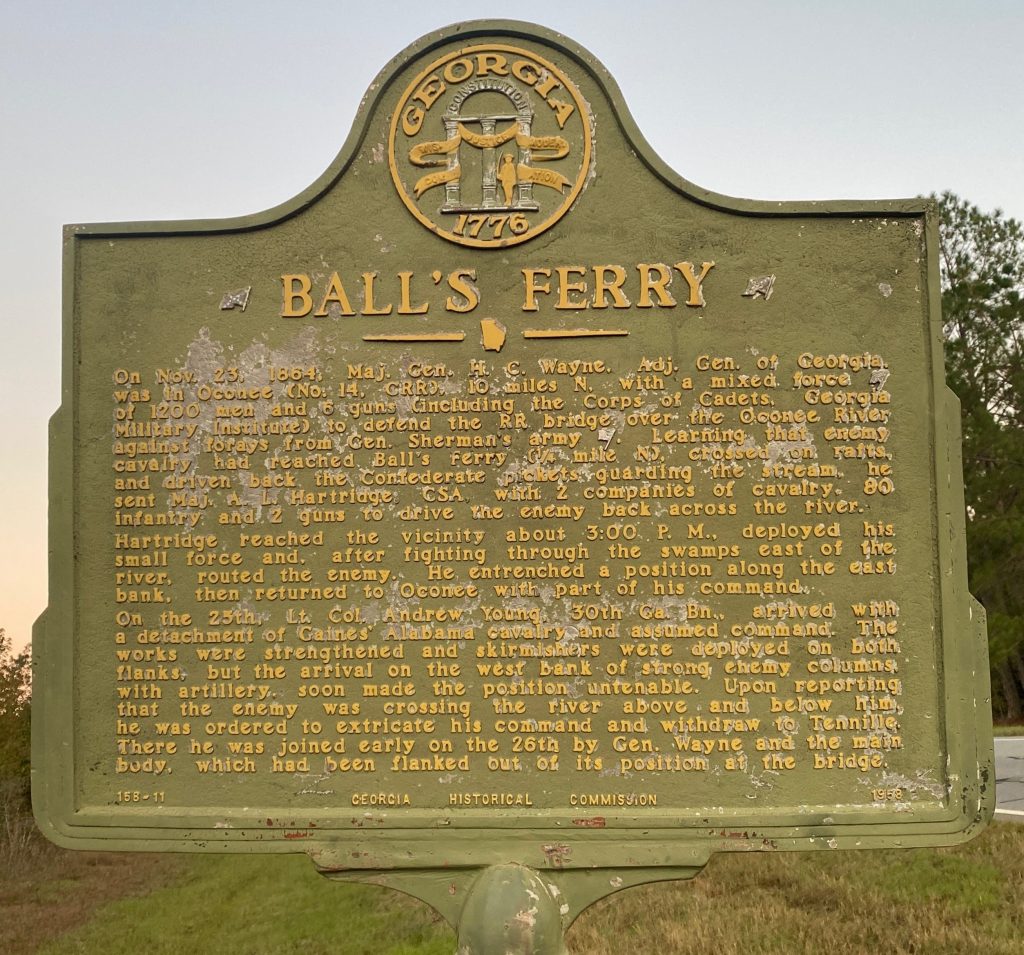
On Nov. 23, 1864, Maj. Gen. C. Wayne, Adj. Gen. of Georgia, was in Oconee (no. 14, CRR), 10 miles N., with a mixed force [Confederate] of 1200 men and 6 guns (including the Corps of cadets, Georgia Military Institute) to defend the RR bridge over the Oconee River against forays from Gen. Sherman’s army [US]. Learning that enemy cavalry had reached Ball’s Ferry (1/4 mile N.), crossed on rafts, and driven back the Confederate pickets guarding the stream, he sent Maj. A.L. Hartridge, CSA, with 2 companies of cavalry, 80 infantry, and 2 guns to drive the enemy back across the river.
Hartridge reached the vicinity about 3:00 P.M., deployed his small force, and, after fighting through the swamps eat of the river, routed the enemy. he entrenched a position along the east bank, then returned to Oconee with part of his command.
On the 25th, Lt. Col. Andrew Young, 30th Ga. Bn., arrived with a detachment of Gaines’ Alabama cavalry and assumed command. The works were strengthened and skirmishers were deployed on both flanks, but the arrival on the west bank of strong enemy columns, with artillery, soon made the position untenable. Upon reporting that the enemy was crossing the river below and above him, he was ordered to extricate his command and withdraw to Tennille. There he was joined early on the 26th by Gen. Wayne and the main body, which had been flanked out of its position at the bridge.
Location
This marker is located on Georgia Highway 57 West, approximately 1/3 of a mile east of the Oconee River bridge and 1.2 miles west of Georgia Highway 68, Oconee area.
This marker was originally located in Wilkinson County; it was moved due to the road and bridge construction.
Marker Number
158-11
Date of Origin